Category:Fields in North Yorkshire
Jump to navigation
Jump to search
Ceremonial counties of England: Bedfordshire · Berkshire · Buckinghamshire · Cambridgeshire · Cheshire · Cornwall · Cumbria · Derbyshire · Devon · Dorset · Durham · East Riding of Yorkshire · East Sussex · Essex · Gloucestershire · Greater London · Greater Manchester · Hampshire · Herefordshire · Hertfordshire · Isle of Wight · Kent · Lancashire · Leicestershire · Lincolnshire · Merseyside · Norfolk · North Yorkshire · Northamptonshire · Northumberland · Nottinghamshire · Oxfordshire · Rutland · Shropshire · Somerset · South Yorkshire · Staffordshire · Suffolk · Surrey · Tyne and Wear · Warwickshire · West Midlands · West Sussex · West Yorkshire · Wiltshire · Worcestershire
City-counties: Bristol ·
Former historic counties:
Other former counties:
City-counties: Bristol ·
Former historic counties:
Other former counties:
Subcategories
This category has the following 17 subcategories, out of 17 total.
- Pastures in North Yorkshire (109 F)
C
- Fields in Craven District (167 F)
H
- Fields in Hambleton District (299 F)
R
- Fields in Richmondshire District (142 F)
- Fields in Ryedale District (304 F)
S
- Fields in the Borough of Scarborough (181 F)
- Fields in Selby District (155 F)
Y
Media in category "Fields in North Yorkshire"
The following 24 files are in this category, out of 24 total.
-
 A Sea of Barley - geograph.org.uk - 441010.jpg 640 × 480; 110 KB
-
 Dry stone wall 05.JPG 1,859 × 1,702; 846 KB
-
 Dry stone wall 06.JPG 2,250 × 1,678; 1,004 KB
-
 Dry stone wall 07.JPG 1,609 × 1,324; 525 KB
-
 Dry stone wall 17.JPG 2,395 × 1,491; 767 KB
-
 Dry stone wall 19.JPG 1,891 × 1,476; 496 KB
-
 Dry stone wall 22.JPG 1,219 × 985; 454 KB
-
_and_the_river_Aire_-_geograph.org.uk_-_6057156.jpg/120px-Ferrybridge%22C%22_power_station_(disused)_and_the_river_Aire_-_geograph.org.uk_-_6057156.jpg) Ferrybridge"C" power station (disused) and the river Aire - geograph.org.uk - 6057156.jpg 3,324 × 2,216; 1.42 MB
Ferrybridge"C" power station (disused) and the river Aire - geograph.org.uk - 6057156.jpg 3,324 × 2,216; 1.42 MB
-
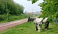
 Field Near Newham Hall - geograph.org.uk - 1223003.jpg 427 × 640; 76 KB
-
 Field off Brass Castle Lane - geograph.org.uk - 1223787.jpg 640 × 427; 86 KB
-
-
 Heather in Yorkshire 02.JPG 2,560 × 1,920; 2.2 MB
-
 King's Mills, Knottingley - geograph.org.uk - 4673983.jpg 640 × 502; 126 KB
-
 M62 west of Stubbs Bridge - geograph.org.uk - 5669880.jpg 640 × 427; 64 KB
-
.jpg/120px-Settle_to_Carlisle_Railway_-_view_of_the_Pennines_(14257408425).jpg) Settle to Carlisle Railway - view of the Pennines (14257408425).jpg 4,320 × 3,240; 4.79 MB
Settle to Carlisle Railway - view of the Pennines (14257408425).jpg 4,320 × 3,240; 4.79 MB
-
 Sheep and pylons alongside the River Aire - geograph.org.uk - 2478023.jpg 1,024 × 768; 143 KB
-
 Sheep grazing on the north bank of the Aire - geograph.org.uk - 2478016.jpg 1,024 × 768; 180 KB
-
 Sunset towards Roseberry - geograph.org.uk - 91936.jpg 640 × 480; 63 KB
-

-
 Arable Field, Nunthorpe - geograph.org.uk - 604209.jpg 427 × 640; 80 KB
-
 Footpath leading to The Grove - geograph.org.uk - 678430.jpg 640 × 480; 102 KB
-
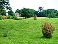
 Grounds of Kirkleavington Hall - geograph.org.uk - 199060.jpg 640 × 384; 85 KB
-
 Grounds of Newham Hall - geograph.org.uk - 335023.jpg 640 × 480; 67 KB
-
 Newly Planted Field, Quarry Hill - geograph.org.uk - 603783.jpg 640 × 427; 79 KB


_and_the_river_Aire_-_geograph.org.uk_-_6057156.jpg)


.jpg)


