Category:Fields in Nottinghamshire
Jump to navigation
Jump to search
Ceremonial counties of England: Bedfordshire · Berkshire · Buckinghamshire · Cambridgeshire · Cheshire · Cornwall · Cumbria · Derbyshire · Devon · Dorset · Durham · East Riding of Yorkshire · East Sussex · Essex · Gloucestershire · Greater London · Greater Manchester · Hampshire · Herefordshire · Hertfordshire · Isle of Wight · Kent · Lancashire · Leicestershire · Lincolnshire · Merseyside · Norfolk · North Yorkshire · Northamptonshire · Northumberland · Nottinghamshire · Oxfordshire · Rutland · Shropshire · Somerset · South Yorkshire · Staffordshire · Suffolk · Surrey · Tyne and Wear · Warwickshire · West Midlands · West Sussex · West Yorkshire · Wiltshire · Worcestershire
City-counties: Bristol ·
Former historic counties:
Other former counties:
City-counties: Bristol ·
Former historic counties:
Other former counties:
Subcategories
This category has the following 8 subcategories, out of 8 total.
Media in category "Fields in Nottinghamshire"
The following 200 files are in this category, out of 451 total.
(previous page) (next page)-
 "Power to the People" - geograph.org.uk - 54918.jpg 640 × 480; 85 KB
-
 A field of poppies - geograph.org.uk - 463233.jpg 640 × 480; 81 KB
-
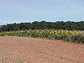 A field of Sunflowers - geograph.org.uk - 40775.jpg 640 × 480; 111 KB
-
 After the harvest - geograph.org.uk - 209487.jpg 640 × 427; 45 KB
-
 Agricultural machinery - geograph.org.uk - 403633.jpg 640 × 480; 121 KB
-
 Agriculture and Industry - geograph.org.uk - 209054.jpg 640 × 427; 54 KB
-
 Arable field - geograph.org.uk - 309133.jpg 640 × 480; 116 KB
-
 Arable Field edge - geograph.org.uk - 403641.jpg 640 × 480; 121 KB
-
 Arable field near Callis Hagg - geograph.org.uk - 1555750.jpg 640 × 480; 142 KB
-
 Babworth MMB 01.jpg 3,783 × 2,019; 2.17 MB
-
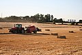 Baler at work - geograph.org.uk - 206989.jpg 640 × 427; 70 KB
-
 Bales and clouds - geograph.org.uk - 213836.jpg 640 × 480; 70 KB
-
 Baling - geograph.org.uk - 206988.jpg 640 × 427; 66 KB
-
 Barn, Near Dell Farm - geograph.org.uk - 102607.jpg 640 × 482; 48 KB
-
 Over the border - geograph.org.uk - 1631648.jpg 640 × 426; 88 KB
-
 Bilsthorpe MMB 01 A614 Old Rufford Road.jpg 4,095 × 2,232; 4.14 MB
-
 Carlton Hall Farm - geograph.org.uk - 1078191.jpg 640 × 427; 72 KB
-
 Carr Farm - geograph.org.uk - 170740.jpg 640 × 480; 64 KB
-
 Carrots - geograph.org.uk - 195683.jpg 640 × 427; 64 KB
-
 Carrots. - geograph.org.uk - 514726.jpg 640 × 358; 90 KB
-
 Caythorpe from the footpath - geograph.org.uk - 1551517.jpg 640 × 479; 127 KB
-
 Springfield, Caythorpe - geograph.org.uk - 1551322.jpg 640 × 479; 143 KB
-
 Cereals and Dung - geograph.org.uk - 25139.jpg 640 × 480; 151 KB
-
 Clay Lane - geograph.org.uk - 802986.jpg 640 × 427; 94 KB
-
 Clay Lane - geograph.org.uk - 802995.jpg 640 × 427; 97 KB
-
 Coal For West Burton - geograph.org.uk - 831035.jpg 640 × 427; 80 KB
-
 Coming down the line - geograph.org.uk - 1013442.jpg 547 × 640; 118 KB
-
 AllSaints Field.jpg 448 × 336; 22 KB
-
 CCP All Saints.JPG 2,361 × 1,635; 1.47 MB
-
 Countryside near Trowell - geograph.org.uk - 620799.jpg 640 × 480; 87 KB
-
_-_geograph.org.uk_-_1771550.jpg/120px-Cultivation_(1)_-_geograph.org.uk_-_1771550.jpg) Cultivation (1) - geograph.org.uk - 1771550.jpg 1,280 × 829; 366 KB
Cultivation (1) - geograph.org.uk - 1771550.jpg 1,280 × 829; 366 KB
-
_-_geograph.org.uk_-_1771552.jpg/120px-Cultivation_(2)_-_geograph.org.uk_-_1771552.jpg) Cultivation (2) - geograph.org.uk - 1771552.jpg 1,280 × 942; 323 KB
Cultivation (2) - geograph.org.uk - 1771552.jpg 1,280 × 942; 323 KB
-
 Disused bridge over the Grand Central Railway- geograph.org.uk - 1745472.jpg 1,280 × 799; 235 KB
-
 Double cross - geograph.org.uk - 1013529.jpg 640 × 510; 147 KB
-
 Drab but not derelict - geograph.org.uk - 1771558.jpg 1,280 × 959; 429 KB
-
 Dry Grass and A1 - geograph.org.uk - 213301.jpg 640 × 480; 109 KB
-
 Dust , sun and heat - geograph.org.uk - 940269.jpg 640 × 448; 73 KB
-
 Dusty Harvest - geograph.org.uk - 221242.jpg 640 × 480; 116 KB
-
-

-
 Farmland and trees near Kilvington - geograph.org.uk - 1021079.jpg 640 × 431; 76 KB
-
 Farmland in the Vale of Belvoir - geograph.org.uk - 1021216.jpg 640 × 453; 104 KB
-
 Farmland near Budby - geograph.org.uk - 774258.jpg 640 × 480; 99 KB
-
 Farmland near Lambley - geograph.org.uk - 1758043.jpg 800 × 600; 163 KB
-
 Farmland near Plungar - geograph.org.uk - 162338.jpg 640 × 427; 163 KB
-
 Farmland near Swingate - geograph.org.uk - 604527.jpg 640 × 480; 122 KB
-
 Farmland off Blidworth Lane - geograph.org.uk - 1761875.jpg 640 × 480; 77 KB
-
 Farmland off Longmoor Lane - geograph.org.uk - 237199.jpg 640 × 427; 104 KB
-
 Farmland on the border - geograph.org.uk - 963276.jpg 640 × 519; 74 KB
-
 Farmland south of Cuckney - geograph.org.uk - 99399.jpg 640 × 423; 81 KB
-
 Farmland South of Ploughman Wood - geograph.org.uk - 1758673.jpg 640 × 480; 91 KB
-
 Farmland, Hatwood Oaks - geograph.org.uk - 1761883.jpg 640 × 480; 65 KB
-
 Fertiliser spreading - geograph.org.uk - 719136.jpg 640 × 427; 63 KB
-
_-_geograph.org.uk_-_940730.jpg/120px-Field_(Gleadthorpe)_-_geograph.org.uk_-_940730.jpg) Field (Gleadthorpe) - geograph.org.uk - 940730.jpg 640 × 480; 102 KB
Field (Gleadthorpe) - geograph.org.uk - 940730.jpg 640 × 480; 102 KB
-
 Field alongside Arnold Lane - geograph.org.uk - 1145352.jpg 640 × 479; 51 KB
-
 Field and Flytipping - geograph.org.uk - 1586015.jpg 426 × 640; 119 KB
-
 Field and Hedges - geograph.org.uk - 1161264.jpg 640 × 400; 81 KB
-
 Field and pwer lines at Toton - geograph.org.uk - 1302500.jpg 640 × 480; 65 KB
-
 Field and Pylons - geograph.org.uk - 239861.jpg 640 × 480; 96 KB
-
 Field at Bunny towards Ratcliffe - geograph.org.uk - 1335615.jpg 640 × 480; 54 KB
-
 Field at Oldcotes - geograph.org.uk - 1041732.jpg 640 × 480; 66 KB
-
 Field at Toton - geograph.org.uk - 1302486.jpg 640 × 480; 79 KB
-
 Field at Toton - geograph.org.uk - 1302503.jpg 640 × 480; 72 KB
-
 Field at Toton - geograph.org.uk - 1302565.jpg 640 × 480; 72 KB
-
 Field beans off Laming Gap Lane - geograph.org.uk - 185855.jpg 640 × 427; 138 KB
-
-
 Field Boundary - geograph.org.uk - 1318989.jpg 640 × 480; 65 KB
-

-
 Field by the A52 - geograph.org.uk - 1517447.jpg 640 × 480; 63 KB
-
 Field drain - geograph.org.uk - 1760356.jpg 640 × 480; 93 KB
-
 Field drain beside Greaves Lane - geograph.org.uk - 1762029.jpg 640 × 480; 133 KB
-
 Field drain beside the B684 - geograph.org.uk - 1758661.jpg 640 × 480; 96 KB
-
 Field footbridge - geograph.org.uk - 983148.jpg 640 × 480; 175 KB
-
 Field Footpath - geograph.org.uk - 1771548.jpg 1,280 × 959; 338 KB
-
 Field gate - geograph.org.uk - 1145347.jpg 640 × 479; 103 KB
-
 Field gate - geograph.org.uk - 905463.jpg 640 × 427; 68 KB
-
 Field Lane - geograph.org.uk - 1478971.jpg 640 × 479; 72 KB
-
 Field near Bunny - geograph.org.uk - 1335702.jpg 640 × 480; 71 KB
-
 Field near Bunny - geograph.org.uk - 1335746.jpg 640 × 480; 74 KB
-
 Field near Bunny - geograph.org.uk - 1335748.jpg 640 × 480; 68 KB
-
 Field near Costock - geograph.org.uk - 1325635.jpg 640 × 480; 51 KB
-
 Field near Gotham - geograph.org.uk - 1771835.jpg 1,280 × 871; 235 KB
-

-
 Field near Wood Farm - geograph.org.uk - 1127220.jpg 640 × 479; 182 KB
-
 Field near Wood Farm - geograph.org.uk - 1127230.jpg 640 × 479; 155 KB
-
 Field of stubble near Hawksworth - geograph.org.uk - 237211.jpg 640 × 427; 86 KB
-

-
 Field on Burton Meadows - geograph.org.uk - 1026093.jpg 640 × 480; 110 KB
-
 Field On Moor Farm - geograph.org.uk - 1160680.jpg 640 × 427; 119 KB
-
.jpg/120px-Field_to_the_west_of_Warsop_Vale_(geograph_5008127).jpg) Field to the west of Warsop Vale (geograph 5008127).jpg 800 × 600; 117 KB
Field to the west of Warsop Vale (geograph 5008127).jpg 800 × 600; 117 KB
-
 Field to Winkburn - geograph.org.uk - 134961.jpg 640 × 480; 75 KB
-
 Field with footpath - geograph.org.uk - 1461681.jpg 640 × 479; 68 KB
-
 Field with footpath - geograph.org.uk - 1461684.jpg 640 × 479; 96 KB
-
 Field, Nuthall - geograph.org.uk - 887179.jpg 640 × 480; 76 KB
-
 Fields alongside Melton Road - geograph.org.uk - 983157.jpg 640 × 480; 95 KB
-
 Fields and B600, Greasley - geograph.org.uk - 1708217.jpg 2,848 × 2,134; 1.16 MB
-
 Fields and Bawtry - geograph.org.uk - 221113.jpg 640 × 480; 90 KB
-
 Fields and Paddock - geograph.org.uk - 1015715.jpg 640 × 427; 71 KB
-
 Fields and Pylons - geograph.org.uk - 54913.jpg 640 × 480; 65 KB
-
 Fields and trees - geograph.org.uk - 1298582.jpg 640 × 480; 183 KB
-
 Fields approaching Woodborough - geograph.org.uk - 1098391.jpg 640 × 480; 133 KB
-

-
 Fields at Bowley's Barn farm - geograph.org.uk - 1298550.jpg 640 × 480; 176 KB
-

-
 Fields at Costock - geograph.org.uk - 1333102.jpg 640 × 480; 61 KB
-
 Fields at Costock - geograph.org.uk - 1333157.jpg 640 × 480; 71 KB
-

-
 Fields at Stapleford - geograph.org.uk - 1302564.jpg 640 × 480; 77 KB
-
 Fields at Toton - geograph.org.uk - 1302492.jpg 640 × 480; 98 KB
-
 Fields at Toton - geograph.org.uk - 1345503.jpg 640 × 480; 40 KB
-
 Fields at Toton - geograph.org.uk - 1345544.jpg 640 × 480; 89 KB
-
 Fields at Toton - geograph.org.uk - 1345598.jpg 640 × 480; 117 KB
-
 Fields at Toton - geograph.org.uk - 1345615.jpg 640 × 480; 114 KB
-

-
 Fields Farm Cottages - geograph.org.uk - 1745417.jpg 1,280 × 959; 239 KB
-
 Fields near Bunny - geograph.org.uk - 1337311.jpg 640 × 480; 66 KB
-
 Fields near Lambley - geograph.org.uk - 1127243.jpg 640 × 479; 153 KB
-
 Fields near Lowdham - geograph.org.uk - 1098271.jpg 640 × 480; 125 KB
-
 Fields near Lowdham - geograph.org.uk - 1098290.jpg 640 × 480; 80 KB
-
_-_geograph.org.uk_-_1323328.jpg/120px-Fields_near_Silverdale_(1)_-_geograph.org.uk_-_1323328.jpg) Fields near Silverdale (1) - geograph.org.uk - 1323328.jpg 640 × 479; 95 KB
Fields near Silverdale (1) - geograph.org.uk - 1323328.jpg 640 × 479; 95 KB
-
_-_geograph.org.uk_-_1323330.jpg/120px-Fields_near_Silverdale_(2)_-_geograph.org.uk_-_1323330.jpg) Fields near Silverdale (2) - geograph.org.uk - 1323330.jpg 640 × 479; 101 KB
Fields near Silverdale (2) - geograph.org.uk - 1323330.jpg 640 × 479; 101 KB
-
 Fields near Silverdale - geograph.org.uk - 1323380.jpg 640 × 479; 89 KB
-
 Fields near Tollerton - geograph.org.uk - 1614755.jpg 640 × 479; 131 KB
-
 Fields near Wolds Farm - geograph.org.uk - 1333452.jpg 640 × 480; 69 KB
-
 Fields North of Bestwood Lodge Drive - geograph.org.uk - 18882.jpg 640 × 480; 195 KB
-

-

-
 Fields on the Thoresby Estate - geograph.org.uk - 261844.jpg 640 × 480; 98 KB
-
 Fields to Hodsock Manor Farm - geograph.org.uk - 127480.jpg 640 × 480; 103 KB
-
 Fields west of Bilborough - geograph.org.uk - 1768339.jpg 640 × 480; 132 KB
-
 Fields, Erewash Valley - geograph.org.uk - 1708296.jpg 3,072 × 2,304; 3.01 MB
-
 Fledborough harvest - geograph.org.uk - 1450958.jpg 640 × 426; 104 KB
-
 Fledborough harvest - geograph.org.uk - 1450966.jpg 640 × 426; 75 KB
-
 Footpath along the Dover Beck - geograph.org.uk - 1551314.jpg 640 × 479; 182 KB
-
 Footpath and Fields - geograph.org.uk - 141081.jpg 640 × 480; 97 KB
-
 Footpath and track near Gildingwells - geograph.org.uk - 309128.jpg 640 × 480; 115 KB
-
 Footpath near Ropsley, Lincolnshire - geograph.org.uk - 155118.jpg 640 × 427; 79 KB
-
 Footpath signpost near Trowell - geograph.org.uk - 620801.jpg 480 × 640; 124 KB
-
 Footpath to Carr Farm - geograph.org.uk - 165117.jpg 640 × 427; 87 KB
-
 Footpath to Kilvington - geograph.org.uk - 1021094.jpg 640 × 459; 93 KB
-
 Footpath to Kneesall - geograph.org.uk - 175146.jpg 640 × 480; 123 KB
-
 Footpath to Obthorpe - geograph.org.uk - 141172.jpg 640 × 480; 89 KB
-
 Freshly Cut Grass - geograph.org.uk - 10421.jpg 640 × 480; 192 KB
-
 Fruit Trees and Feeder - geograph.org.uk - 214466.jpg 640 × 480; 94 KB
-
 Gate and pylons - geograph.org.uk - 1537045.jpg 640 × 460; 57 KB
-
 Gate with initials. - geograph.org.uk - 511433.jpg 640 × 480; 125 KB
-
_09_-_IMG_9613.jpg/120px-Grimme_Combi_Star_CS_1700_trailed_destoner_(at_Blyth_Notts)_09_-_IMG_9613.jpg) Grimme Combi Star CS 1700 trailed destoner (at Blyth Notts) 09 - IMG 9613.jpg 2,256 × 1,504; 1.49 MB
Grimme Combi Star CS 1700 trailed destoner (at Blyth Notts) 09 - IMG 9613.jpg 2,256 × 1,504; 1.49 MB
-
 Breaking the soil - geograph.org.uk - 1551520.jpg 640 × 479; 162 KB
-
 Breaking the soil - geograph.org.uk - 1551523.jpg 640 × 426; 167 KB
-
 Flood in Harby - geograph.org.uk - 482317.jpg 640 × 427; 59 KB
-
 Footpath from Clay Lane - geograph.org.uk - 800035.jpg 640 × 427; 76 KB
-
 Ox Pasture Drain in flood - geograph.org.uk - 479058.jpg 640 × 427; 85 KB
-
 Ox Pasture Drain in flood - geograph.org.uk - 479060.jpg 640 × 427; 68 KB
-
 Power Lines - geograph.org.uk - 1005227.jpg 640 × 427; 61 KB
-
 Harvest near Rampton - geograph.org.uk - 211324.jpg 640 × 427; 56 KB
-
 Harvest time on Trowell Moor - geograph.org.uk - 46312.jpg 640 × 480; 46 KB
-
 Harvested field south of Tile Kiln Wood - geograph.org.uk - 1480251.jpg 640 × 480; 224 KB
-
 All Saints Church, Hawton - geograph.org.uk - 394697.jpg 640 × 424; 146 KB
-
 St. Peter's, Hayton from the Canal - geograph.org.uk - 451530.jpg 640 × 480; 87 KB
-
 High Marnham Power Station.jpg 3,000 × 859; 794 KB
-
 Horses in a Field - geograph.org.uk - 1016505.jpg 640 × 480; 61 KB
-
 Industrial units, Harworth - geograph.org.uk - 1226715.jpg 640 × 480; 95 KB
-
 Irrigation pump - geograph.org.uk - 1513259.jpg 640 × 465; 87 KB
-
 Irrigator - geograph.org.uk - 903432.jpg 640 × 427; 71 KB
-
 Jubilee Campus MMB S1.jpg 3,936 × 2,172; 4.17 MB
-
 Kirkby-in-Ashfield - cornfield and church - geograph.org.uk - 665341.jpg 600 × 400; 110 KB
-
 Landscape near Lambley - geograph.org.uk - 1013537.jpg 640 × 480; 153 KB
-
 Lane and path off Retford Road. - geograph.org.uk - 514696.jpg 640 × 389; 94 KB
-
 Laxton village.png 400 × 300; 231 KB
-
 Liquorice Lane farmland - geograph.org.uk - 1076345.jpg 640 × 427; 71 KB
-
 Looking towards Holme Farm - geograph.org.uk - 746336.jpg 640 × 427; 97 KB
-
 Looking towards Sutton Fields House - geograph.org.uk - 738075.jpg 640 × 480; 67 KB
-
 M1 near Trowell - geograph.org.uk - 620798.jpg 640 × 480; 87 KB
-
 Manor Farm recreation ground - geograph.org.uk - 723594.jpg 640 × 427; 60 KB
-
 Millions of Carrots - geograph.org.uk - 189767.jpg 640 × 480; 85 KB
-
 Yet another shot of Milton Mausoleum - geograph.org.uk - 635967.jpg 640 × 480; 128 KB
-
 Mint imperials - geograph.org.uk - 520698.jpg 640 × 480; 104 KB
-
 Bridleway to bracken Hill Lane - geograph.org.uk - 1395343.jpg 640 × 407; 82 KB
-
 Mowing the lawn ^ - geograph.org.uk - 496594.jpg 640 × 427; 40 KB
-
 North Clifton farmland - geograph.org.uk - 195233.jpg 640 × 427; 63 KB
-
 North Leverton with Habblesthorpe MMB 01.jpg 3,936 × 2,172; 3.09 MB
-
 North Leverton with Habblesthorpe MMB 02 Sheffield to Lincoln Line 144006.jpg 3,796 × 2,232; 2.25 MB
-
 North-side of the Hedge - geograph.org.uk - 773849.jpg 640 × 427; 146 KB
-
 Nottinghamshire landscape - geograph.org.uk - 1013533.jpg 640 × 480; 153 KB
-
 Oak near Robin Rood Way - geograph.org.uk - 761040.jpg 640 × 427; 183 KB
-
 Path on Fox Hill - geograph.org.uk - 721107.jpg 640 × 480; 65 KB
-
 Piles of muck - geograph.org.uk - 241192.jpg 640 × 480; 64 KB
-

-

-
 Ploughed Field at Toton - geograph.org.uk - 1345584.jpg 640 × 480; 137 KB
-
 Ploughed field near Kilvington - geograph.org.uk - 1021035.jpg 640 × 529; 103 KB
-
 Ploughing The Old Way - geograph.org.uk - 68724.jpg 640 × 480; 118 KB
-
 Pond on Barton Moor - geograph.org.uk - 1772576.jpg 1,280 × 959; 246 KB
-
 Poppies - geograph.org.uk - 189029.jpg 640 × 427; 74 KB
-
 Potato irrigation - geograph.org.uk - 1364197.jpg 640 × 426; 94 KB
-
 Potato patch - geograph.org.uk - 838759.jpg 640 × 426; 105 KB
-

-

-
 Rare Square Bales - geograph.org.uk - 239863.jpg 640 × 480; 93 KB
-
 Red onions - geograph.org.uk - 896882.jpg 640 × 427; 64 KB


_-_geograph.org.uk_-_1771550.jpg)
_-_geograph.org.uk_-_1771552.jpg)


_-_geograph.org.uk_-_940730.jpg)


.jpg)


_-_geograph.org.uk_-_1323328.jpg)
_-_geograph.org.uk_-_1323330.jpg)


_09_-_IMG_9613.jpg)


