Category:July 2006 in Lincolnshire
Jump to navigation
Jump to search
Deutsch: Bilder, die im Juli 2006 in Lincolnshire aufgenommen worden sind. Bitte beachten Sie, dass dies weder das Datum des Uploads noch das Datum des Scannens eines Fotos ist.
English: Images/pictures taken in Lincolnshire during July 2006. Note this is not the date of the upload, nor the date a photo was scanned.
Español: Fotografías o imágenes tomadas en Lincolnshire durante julio 2006. No es la fecha de subida ni escaneo, sino la fecha en que las fotografías o imágenes se crearon.
Esperanto: Bildoj faritaj en Lincolnshire en julio 2006. Tio ne estas la dato, kiam la bildoj estis alŝutitaj aŭ skanitaj.
Français : Photographies ou images prises en Lincolnshire durant juillet 2006. Ce n'est pas la date du téléchargement ou du scan.
Galego: Fotografías ou imaxes tomadas en Lincolnshire durante xullo 2006. Non é a data de subida nin escaneamento, senón a data na que se crearon as fotografías ou imaxes.
Italiano: Fotografie o immagini scattate a Lincolnshire nel luglio 2006. Nota bene: la data non si riferisce né a quella di upload né a quella in cui la foto è stata digitalizzata.
Norsk bokmål: Bilder tatt i Lincolnshire i løpet av juli 2006. Merk at dette ikke er datoen for opplasting, eller når et bilde har blitt skannet.
Norsk nynorsk: Bilete teke i Lincolnshire i løpet av juli 2006. Merk at dette ikkje er datoen for opplasting, eller når eit bilete har vorte skanna.
Русский: Изображения, сделанные в Lincolnshire в течение июль 2006 (не дата загрузки изображения).
Українська: Зображення, зроблені в Lincolnshire протягом липень 2006. Зауважте, що це не дата завантаження чи дата сканування фотографії.
| July 2005 | ← | July 2006 | → | July 2007 | |||||||
| Jan | Feb | Mar | Apr | May | Jun | Jul | Aug | Sep | Oct | Nov | Dec |
| 72 | 62 | 99 | 194 | 106 | 106 | 155 | 155 | 151 | 123 | 129 | 56 |
|---|---|---|---|---|---|---|---|---|---|---|---|
Subcategories
This category has the following 12 subcategories, out of 12 total.
W
- 2006 RAF Waddington Air Show (7 F)
Media in category "July 2006 in Lincolnshire"
The following 143 files are in this category, out of 143 total.
-
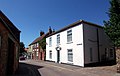
 Church of St. Peter - geograph.org.uk - 310820.jpg 640 × 480; 116 KB
-
 Priestgate, Barton-Upon-Humber - geograph.org.uk - 199578.jpg 640 × 480; 101 KB
-
 Your Local Costcutter - geograph.org.uk - 200070.jpg 640 × 451; 89 KB
-
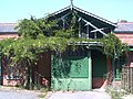
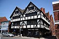 Shodfriars Hall - geograph.org.uk - 200119.jpg 640 × 427; 75 KB
-
 Goxhill Haven - geograph.org.uk - 310828.jpg 640 × 374; 106 KB
-
 Barton Veterinary Centre - geograph.org.uk - 201945.jpg 640 × 562; 155 KB
-
 Recycling Facility, Gravel Pit Lane - geograph.org.uk - 201947.jpg 640 × 445; 103 KB
-
 The Old Police Station, High Street - geograph.org.uk - 202297.jpg 640 × 480; 120 KB
-
 Glebe Farm, Little Bytham - geograph.org.uk - 203048.jpg 640 × 480; 76 KB
-
 View from Low Belmont Farm, Lincs - geograph.org.uk - 235194.jpg 640 × 480; 23 KB
-
 Burgess Road, Brigg - geograph.org.uk - 203664.jpg 640 × 480; 139 KB
-
 Rural Fringe of Brigg - geograph.org.uk - 203677.jpg 640 × 480; 139 KB
-
 The Eastern edge of Brigg - geograph.org.uk - 203575.jpg 640 × 480; 111 KB
-
 Reedbed - geograph.org.uk - 205080.jpg 640 × 480; 145 KB
-
 West Marsh Lane Crossing - geograph.org.uk - 205087.jpg 640 × 480; 128 KB
-
 Barton Upon Humber - geograph.org.uk - 586864.jpg 480 × 640; 131 KB
-
 Fields - geograph.org.uk - 194551.jpg 640 × 480; 70 KB
-
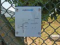 Anglian Water Reservoir - geograph.org.uk - 410146.jpg 640 × 480; 141 KB
-
 Hedge Development - geograph.org.uk - 194314.jpg 640 × 480; 138 KB
-

-
 Clough Bridge, Gosberton Clough, Lincs - geograph.org.uk - 259146.jpg 640 × 480; 397 KB
-

-

-

-
 Kirkby Moor - geograph.org.uk - 197311.jpg 640 × 427; 88 KB
-
 Set aside at North Scarle - geograph.org.uk - 195678.jpg 640 × 427; 72 KB
-
 Scrivelsby Farmland - geograph.org.uk - 197293.jpg 640 × 427; 42 KB
-
 Towards Scrivelsby Beck - geograph.org.uk - 197296.jpg 640 × 427; 65 KB
-
 View towards Horncastle - geograph.org.uk - 197302.jpg 640 × 427; 58 KB
-
 Barrow Haven - Rosebay Willowherb - geograph.org.uk - 197870.jpg 640 × 426; 173 KB
-
 Oddfellows Hall - geograph.org.uk - 199156.jpg 640 × 510; 131 KB
-

-
 The Royal Oak, Barrow-Upon-Humber - geograph.org.uk - 200060.jpg 640 × 463; 110 KB
-
 The Six Bells, Barrow-Upon-Humber - geograph.org.uk - 200057.jpg 640 × 467; 106 KB
-
 The Golden Lion - geograph.org.uk - 201578.jpg 640 × 427; 62 KB
-
 Haven Farm, Goxhill Haven - geograph.org.uk - 200186.jpg 640 × 426; 136 KB
-
 Old Runway at Goxhill Airfield - geograph.org.uk - 200277.jpg 640 × 426; 95 KB
-
 Old Taxi Strip at Goxhill Airfield - geograph.org.uk - 311030.jpg 640 × 365; 88 KB
-
_-_geograph.org.uk_-_200229.jpg/120px-Spot_Height_5m_(Red)_-_geograph.org.uk_-_200229.jpg) Spot Height 5m (Red) - geograph.org.uk - 200229.jpg 640 × 426; 121 KB
Spot Height 5m (Red) - geograph.org.uk - 200229.jpg 640 × 426; 121 KB
-
 Central House, Winterton - geograph.org.uk - 201446.jpg 640 × 480; 145 KB
-
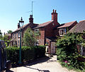
 Dent's Cottage, 92 Park Street, Winterton - geograph.org.uk - 201424.jpg 640 × 501; 109 KB
-
 Market Street, Winterton - geograph.org.uk - 201448.jpg 640 × 475; 128 KB
-
 Market Street, Winterton - geograph.org.uk - 206307.jpg 640 × 480; 90 KB
-
 Market Street, Winterton - geograph.org.uk - 311038.jpg 640 × 406; 80 KB
-
 No. 3 Chapel Lane - geograph.org.uk - 205257.jpg 640 × 551; 143 KB
-

-
 The Butchers Arms, Winterton - geograph.org.uk - 201453.jpg 640 × 495; 96 KB
-
 Trinity Methodist Church - geograph.org.uk - 201451.jpg 640 × 478; 79 KB
-
 Wesley Cottage, Winterton - geograph.org.uk - 201961.jpg 640 × 473; 100 KB
-
 Winterton High Street - geograph.org.uk - 206864.jpg 640 × 432; 80 KB
-
 Winterton Post Office - geograph.org.uk - 201441.jpg 640 × 541; 149 KB
-
 Beech House, Low Street, Winterton - geograph.org.uk - 201978.jpg 640 × 530; 113 KB
-
 Earlscote, 11 High Street, Winterton - geograph.org.uk - 201981.jpg 640 × 480; 102 KB
-
 The George Inn - geograph.org.uk - 205467.jpg 640 × 478; 133 KB
-
 The Old Police Station, Winterton - geograph.org.uk - 201953.jpg 640 × 506; 140 KB
-
 Wing-Wah Chinese Takeaway, Winterton - geograph.org.uk - 201956.jpg 640 × 551; 133 KB
-
 Winterton - The Old Telephone Exchange - geograph.org.uk - 201949.jpg 511 × 640; 122 KB
-
 Winterton Cemetery - geograph.org.uk - 201964.jpg 640 × 478; 127 KB
-
 Winterton War Memorial - geograph.org.uk - 201972.jpg 522 × 640; 167 KB
-
-
 Near Three Trees Farm - geograph.org.uk - 203577.jpg 640 × 480; 117 KB
-
 North of Star Carr Lane - geograph.org.uk - 203681.jpg 640 × 480; 126 KB
-
 Star Carr Lane - geograph.org.uk - 203660.jpg 640 × 480; 117 KB
-
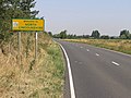 County Boundary - geograph.org.uk - 206690.jpg 640 × 480; 104 KB
-

-
 Humber Bridge Water Ski Club - geograph.org.uk - 204900.jpg 640 × 480; 135 KB
-
 Track off West Marsh Lane - geograph.org.uk - 204959.jpg 480 × 640; 116 KB
-
 West Marsh Farm - geograph.org.uk - 204954.jpg 640 × 497; 113 KB
-
 West Marsh Lane - geograph.org.uk - 204953.jpg 640 × 480; 121 KB
-
 Potatoes and Water - geograph.org.uk - 206691.jpg 640 × 480; 105 KB
-
 West Common North Road - geograph.org.uk - 206695.jpg 640 × 480; 94 KB
-
 Field on Barkston Heath - geograph.org.uk - 208726.jpg 640 × 427; 114 KB
-
 House in Boston 02.JPG 2,560 × 1,920; 1.2 MB
-
 Houses in Boston 01.JPG 2,560 × 1,920; 1.19 MB
-
 Houses in Boston 02.JPG 2,560 × 1,920; 1.19 MB
-
 Houses in Boston 03.JPG 2,560 × 1,920; 1.19 MB
-
 Farmland near Welby - geograph.org.uk - 208797.jpg 640 × 427; 122 KB
-
 Farmland near Welby - geograph.org.uk - 208798.jpg 640 × 427; 74 KB
-
 Farmland off Green Lane - geograph.org.uk - 208802.jpg 640 × 427; 81 KB
-
 Harvested field - geograph.org.uk - 208693.jpg 640 × 427; 119 KB
-
 Elsham Crossing - geograph.org.uk - 583525.jpg 640 × 480; 70 KB
-
 Signal Box at Elsham - geograph.org.uk - 583556.jpg 480 × 640; 77 KB
-
 Country lane through Woodnook Valley - geograph.org.uk - 211746.jpg 640 × 427; 85 KB
-
 Countryside at Woodnook Valley - geograph.org.uk - 211655.jpg 640 × 427; 84 KB
-

-
 Woodnook Farm house - geograph.org.uk - 211652.jpg 640 × 427; 106 KB
-
 Awaiting Harvesting - geograph.org.uk - 211546.jpg 640 × 420; 127 KB
-
 Former A17 - geograph.org.uk - 214114.jpg 640 × 480; 77 KB
-
 Former A17 - geograph.org.uk - 214121.jpg 640 × 480; 61 KB
-
.jpg/120px-National_Archaeology_Week_at_North_Lincolnshire_Museum_(case_study).jpg) National Archaeology Week at North Lincolnshire Museum (case study).jpg 2,475 × 1,887; 1.49 MB
National Archaeology Week at North Lincolnshire Museum (case study).jpg 2,475 × 1,887; 1.49 MB
-
 Barton-Upon-Humber War Memorial - geograph.org.uk - 207179.jpg 640 × 510; 107 KB
-
 Barton-Upon-Humber War Memorial - geograph.org.uk - 207186.jpg 640 × 480; 95 KB
-
 Ermine Street - geograph.org.uk - 208707.jpg 640 × 427; 92 KB
-
 Pyewipe Cottages - geograph.org.uk - 208703.jpg 640 × 427; 72 KB
-

-
-
 06-Lincoln-008.jpg 2,448 × 3,264; 5.06 MB
-
 06-Lincoln-010.jpg 3,264 × 2,448; 4.76 MB
-
 06-Lincoln-012.jpg 2,448 × 3,264; 4.74 MB
-
 06-Lincoln-013.jpg 2,448 × 3,264; 5.05 MB
-
 06-Lincoln-059.jpg 2,448 × 3,264; 3.56 MB
-
 06-Lincoln-061.jpg 2,448 × 3,264; 5.77 MB
-
 Market Lane - geograph.org.uk - 220932.jpg 640 × 480; 118 KB
-
 Somerfield's - geograph.org.uk - 209617.jpg 640 × 479; 109 KB
-
 The Ropewalk - geograph.org.uk - 210686.jpg 640 × 426; 99 KB
-
 Wet Monday Afternoon in Brigg - geograph.org.uk - 211970.jpg 640 × 480; 126 KB
-

-
 Old A17 meets new A17 - geograph.org.uk - 214112.jpg 640 × 480; 70 KB
-
 Towards Leadenham - geograph.org.uk - 214122.jpg 640 × 480; 87 KB
-
 Barnetby Railway Station.jpg 1,600 × 1,227; 828 KB
-
 Barrow Haven Station.jpg 640 × 529; 138 KB
-
 Barton Haven - geograph.org.uk - 206309.jpg 480 × 640; 83 KB
-
 Boothby Graffoe Low Fields - geograph.org.uk - 197320.jpg 640 × 427; 74 KB
-
 Borage Field - geograph.org.uk - 201412.jpg 640 × 480; 205 KB
-
 Brylaine XAZ1313 - Flickr - megabus13601.jpg 2,048 × 1,536; 749 KB
-
.jpg/120px-Brylaine_XAZ1320_-_Flickr_-_megabus13601_(1).jpg) Brylaine XAZ1320 - Flickr - megabus13601 (1).jpg 2,048 × 1,536; 732 KB
Brylaine XAZ1320 - Flickr - megabus13601 (1).jpg 2,048 × 1,536; 732 KB
-
.jpg/120px-Brylaine_XAZ1410_-_Flickr_-_megabus13601_(1).jpg) Brylaine XAZ1410 - Flickr - megabus13601 (1).jpg 2,048 × 1,536; 802 KB
Brylaine XAZ1410 - Flickr - megabus13601 (1).jpg 2,048 × 1,536; 802 KB
-
 Chichester Road, Cleethorpes - geograph.org.uk - 201408.jpg 640 × 427; 68 KB
-
 Dappled Bridge - geograph.org.uk - 213258.jpg 640 × 480; 147 KB
-

-
 Ford, Dunholme - geograph.org.uk - 215437.jpg 640 × 480; 80 KB
-
 Glebe Farm from Dog Hill - geograph.org.uk - 207278.jpg 640 × 427; 66 KB
-
 Humber bridge, UK.jpg 1,024 × 768; 347 KB
-
 Humber bridge, UK2.jpg 530 × 477; 244 KB
-
 Lincolnshire Wolds view.jpg 640 × 427; 59 KB
-
 Minster Green - geograph.org.uk - 201613.jpg 640 × 427; 83 KB
-
 Off Star Carr Lane - geograph.org.uk - 311130.jpg 640 × 376; 92 KB
-
 The muddy beach of Cleethorpes - panoramio.jpg 1,564 × 1,557; 311 KB
-
 West Marsh Lane Level Crossing - geograph.org.uk - 204949.jpg 640 × 480; 104 KB
-
 Beware of the bull - geograph.org.uk - 208102.jpg 640 × 427; 96 KB
-
 Disused Poultry Farm at New Green - geograph.org.uk - 200251.jpg 640 × 265; 83 KB
-

-

-
-
 Humber Mud Bank - geograph.org.uk - 200212.jpg 640 × 426; 53 KB
-
 Lincoln Reds - geograph.org.uk - 203843.jpg 640 × 427; 80 KB
-
 Looking towards Wootton Wold - geograph.org.uk - 196174.jpg 640 × 480; 94 KB
-
 Near Wootton Wold - geograph.org.uk - 194409.jpg 640 × 480; 106 KB
-
 Path to Messingham - geograph.org.uk - 206693.jpg 640 × 480; 120 KB
-
 Road Junction at "The Poplars" - geograph.org.uk - 200235.jpg 640 × 426; 111 KB
-
 Wharfside building - geograph.org.uk - 201585.jpg 427 × 640; 51 KB
-
 Willoughby Hills - geograph.org.uk - 197275.jpg 640 × 427; 116 KB
-


_-_geograph.org.uk_-_200229.jpg)


.jpg)


.jpg)
.jpg)


