Category:Pode Hole
Jump to navigation
Jump to search
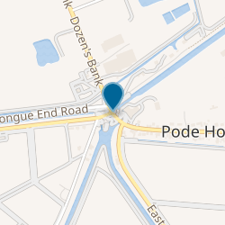
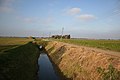
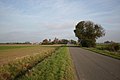
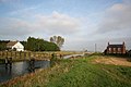
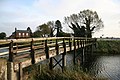
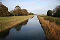
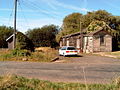
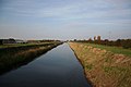
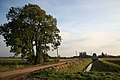
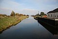
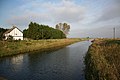
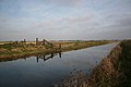
English: Pode Hole is a small village to the west of Spalding at the confluence of several drainage channels. Two pumping stations discharge water into Vernatt's Drain from land in Deeping Fen to the South and West. Water from Pinchbeck South Fen to the North is also lifted into Vernatt's Drain. The village arose to service the pumping stations.
village in United Kingdom  | |||||
| Upload media | |||||
| Instance of | |||||
|---|---|---|---|---|---|
| Location | South Holland, Lincolnshire, East Midlands, England | ||||
 | |||||
Media in category "Pode Hole"
The following 37 files are in this category, out of 37 total.
-
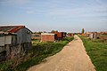 Allotment Gardens - geograph.org.uk - 275226.jpg 640 × 427; 53 KB
-
 Cross Dyke - geograph.org.uk - 275256.jpg 640 × 427; 48 KB
-
 Cuckoo Bridge - geograph.org.uk - 275220.jpg 640 × 427; 72 KB
-
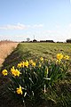
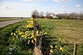 Daffodils at Poplar Farm - geograph.org.uk - 364837.jpg 640 × 427; 96 KB
-
 Delph Drain floodgates - geograph.org.uk - 274840.jpg 640 × 427; 53 KB
-
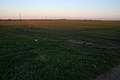 Farmland on Deeping Fen - geograph.org.uk - 589855.jpg 640 × 427; 65 KB
-
 Fourth District Main Drain - geograph.org.uk - 275227.jpg 640 × 427; 59 KB
-
 Horseshoe Road - geograph.org.uk - 275223.jpg 640 × 427; 49 KB
-
 Jobson's Bridge - geograph.org.uk - 275235.jpg 640 × 427; 55 KB
-
 Jobson's Bridge - geograph.org.uk - 275237.jpg 640 × 427; 79 KB
-
.jpg) Mobile Library (geograph 3691202).jpg 4,896 × 3,264; 6.07 MB
Mobile Library (geograph 3691202).jpg 4,896 × 3,264; 6.07 MB
-
 North Drove Drain from Cuckoo Bridge - geograph.org.uk - 275218.jpg 640 × 427; 57 KB
-
 North Drove Station-Geograph-1568398-by-martyn-brisland.jpg 640 × 480; 116 KB
-
 Pinchbeck Common - geograph.org.uk - 275229.jpg 640 × 427; 59 KB
-
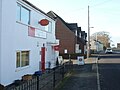 Pode Hole, the post office.jpg 640 × 480; 60 KB
-
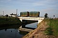
 Rail bridge over South Drove Drain - geograph.org.uk - 364320.jpg 640 × 427; 69 KB
-
 South Drove Drain - geograph.org.uk - 275213.jpg 640 × 427; 37 KB
-
 South Drove Drain Bank - geograph.org.uk - 364863.jpg 640 × 427; 74 KB
-
 South Fen - geograph.org.uk - 418573.jpg 640 × 468; 55 KB
-
 The Fisherman's Arms - geograph.org.uk - 274830.jpg 640 × 427; 55 KB
-
 Tydd Road - geograph.org.uk - 275257.jpg 640 × 427; 68 KB
-
 Ubiquitous daffodils - geograph.org.uk - 364874.jpg 427 × 640; 73 KB
-
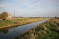
 Vernatt's Drain - geograph.org.uk - 274836.jpg 640 × 427; 34 KB
-
 Vernatt's Drain - geograph.org.uk - 275252.jpg 640 × 427; 55 KB
-
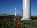 Base of Wind Turbine , Vine House Farm - geograph.org.uk - 281456.jpg 640 × 480; 101 KB
-
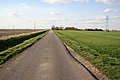
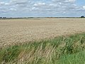 Cereal land north of North Drove - geograph.org.uk - 1429072.jpg 640 × 480; 186 KB
-
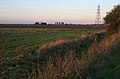 Farmland off North Drove - geograph.org.uk - 589856.jpg 640 × 422; 87 KB
-
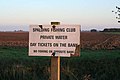 Fishing from this side only - geograph.org.uk - 589849.jpg 640 × 427; 74 KB
-
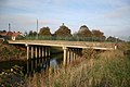
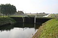
 Horseshoe Bridge - geograph.org.uk - 275212.jpg 640 × 427; 57 KB
-
 Jordan's Cradge Bank Road - geograph.org.uk - 364854.jpg 640 × 427; 61 KB
-
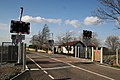 Lucks Road level crossing - geograph.org.uk - 364306.jpg 640 × 427; 71 KB
-
 Pepper Hill Farm - geograph.org.uk - 589848.jpg 640 × 427; 111 KB
-
 Pinchbeck South Fen - geograph.org.uk - 275231.jpg 640 × 427; 39 KB
-
 Spalding Common - geograph.org.uk - 364850.jpg 640 × 427; 54 KB
-
-
 Wind Turbine, Vine House Farm - geograph.org.uk - 281444.jpg 480 × 640; 66 KB
-
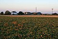
 Wind Turbines, Worth's Farm - geograph.org.uk - 281491.jpg 640 × 480; 102 KB